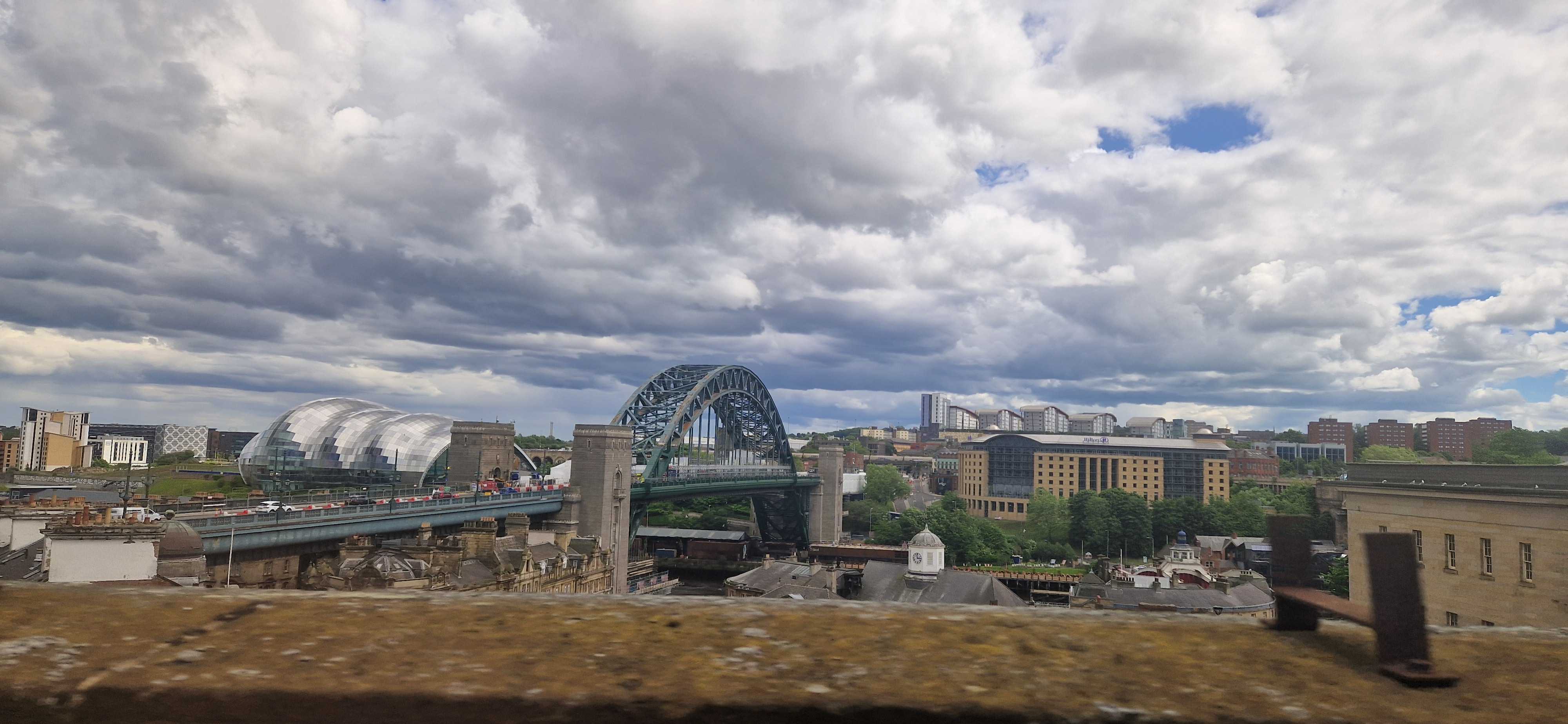
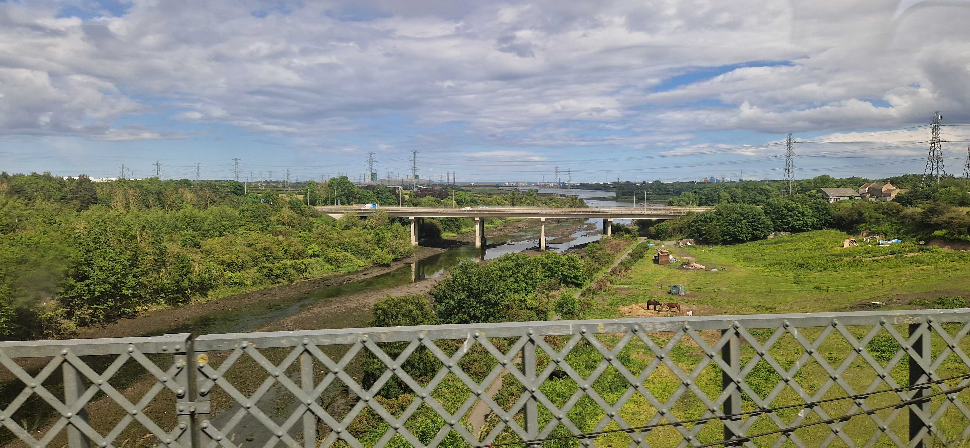
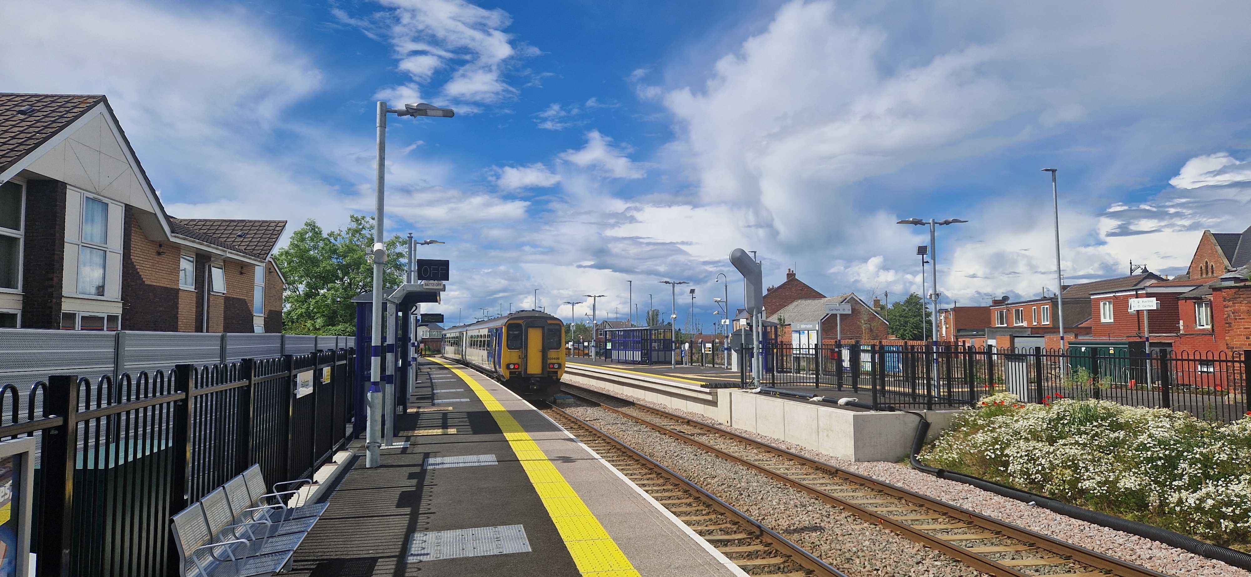
The Tyne and Wear Metro is a marvel of the British railway network: the only true metro system outside of London and Glasgow1, with fully accessible stations, beautiful typographic design, and only the occasional closure because someone stole all the copper wiring again. But amongst railway nerds, it is also known for one more puzzling detail: it’s a pretzel.
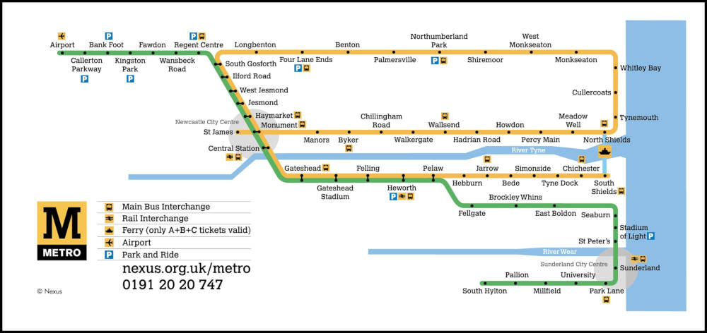
That’s right: you can, if you want, catch a Yellow Line train at Monument, go all the way around the coast, wind up right back where you started, and continue all the way down to South Shields just to rub it in. Put otherwise: there are four platforms and they’re all for the same line.
This is, as far as i know, unique to Newcastle. Bucharest almost gets there, but chickens out just before the line actually crosses over. Sofia nearly pulls it off but, in a shocking display of cowardice, redesignates its Line 4 as “Line 2” halfway through the loop, disqualifying them immediately. The Hague does something even more complicated, but it’s on a tramway and i can’t in good faith count it. And Vancouver used to have the same setup — even using the same colour — but switched to a perhaps more sensible timetabling in 2016 when an extension rendered it unworkable.
So… why? What’s the point? Let’s find out.
As is often the case with urban rail, the constituent parts of the Tyne and Wear Metro were built at different times by different, competing companies, and were only later stitched together into a coherent network.
The first part of the loop to come online was the Newcastle and North Shields Railway, starting in 1839, who ran a service from the centre of town to (where else?) North Shields, later extended a teensy bit further to Tynemouth. The N&NSR’s mighty viaducts still carry our dinky yellow trains over the Ouseburn to this day.
Meanwhile, further north, coal mining in Northumberland was growing rapidly. (This brought great prosperity to the region, which would surely never ever end. Ever. Unless they closed the mines, but come on, why would that ever happen?) The existing main-lines found themselves choked by the influx of traffic, and in 1852, Parliament authorised the incorporation of the newfangled Blyth and Tyne Railway.
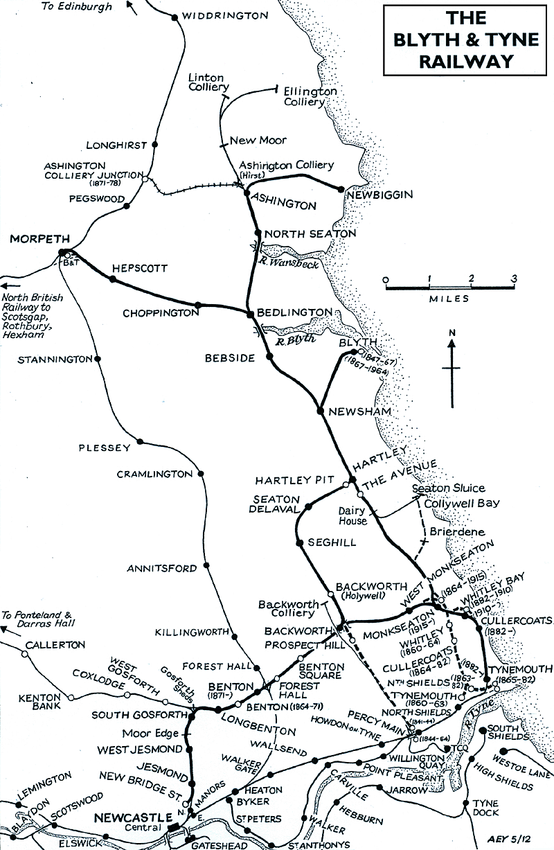
The B&T at first linked Bedlington and Blyth only to the staiths at Percy Main, but by the eighteen-sixties it had added branches to the centre of town — encouraging buildup in Newcastle’s northern suburbs — and to the growing seaside holiday destination of… Tynemouth.
Hm.
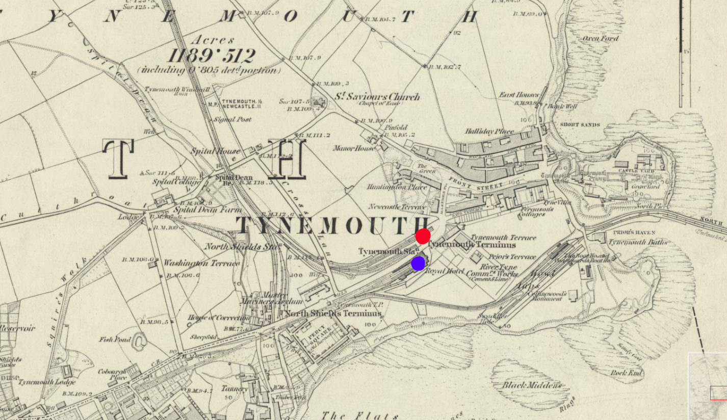
By the early eighteen-eighties, both the B&T and the N&NSR had been absorbed into the North Eastern Railway, which found itself in the awkward position of having two formerly competing stations right next to each other and no way for trains to transfer between the two. So, in 1882, the two competitors’ lines were linked up with a new alignment running closer to the coast, including the opening of a gorgeous palatial through station at Tynemouth, still in use by Metro trains and Sunday markets to this day.
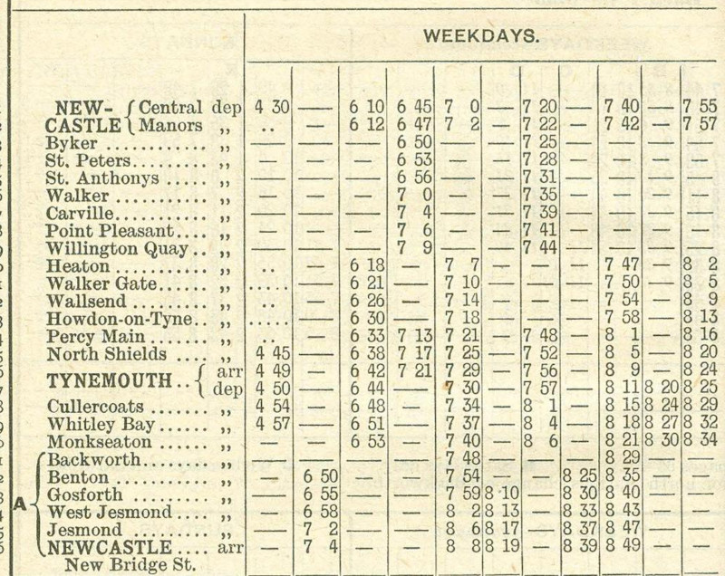
The earliest timetable i could find, from 1902, shows that trains were indeed running in a loop around the coast, from the city centre to Wallsend to Tynemouth and back, just as is possible today.
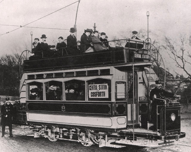
At the dawn of the twentieth century, however, the steam services were threatened by a rising competitor: the tram. No longer did you have to put up with noisy, steam-belching locomotives every day — you could get to exactly where you wanted to go, in style! This, of course, wouldn’t do, and so the NER embarked on a rapid programme of electrification. By 1904, the loop had fully switched over, and the network was rechristened the ✨️ Tyneside Electrics! ✨️
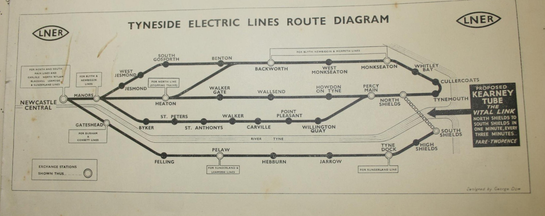
By this point, the network clearly resembled what we have today. Now, it didn’t quite loop over itself like today — everything went through Central Station; no perpendicular Monument tomfoolery here — and there was an extra branch snaking along the riverside which was never refurbished for the Metro era. But other than that, the geometry was pretty well set, and there would be no major service changes until the introduction of — what do you mean, you want to know what the big black arrow’s for?
Whenever i show a diagram of the Metro to my non-Geordie friends, the first response is usually something to the effect of, “Why isn’t there a link between North and South Shields?” It’s a fair question, and the canned answer i usually give is that building one would be a lot of expense for little point, since there’s already a well-trafficked, well-loved ferry service between the two. Little did i know that it could well have been otherwise.
Elfric Wells Chalmers Kearney was an eccentric Australian engineer who spent much of his life trying and failing to convince city governments to adopt his all-new danglebahn, the Kearney High-speed Tube™. Here he is in 1910 with a model he made earlier:
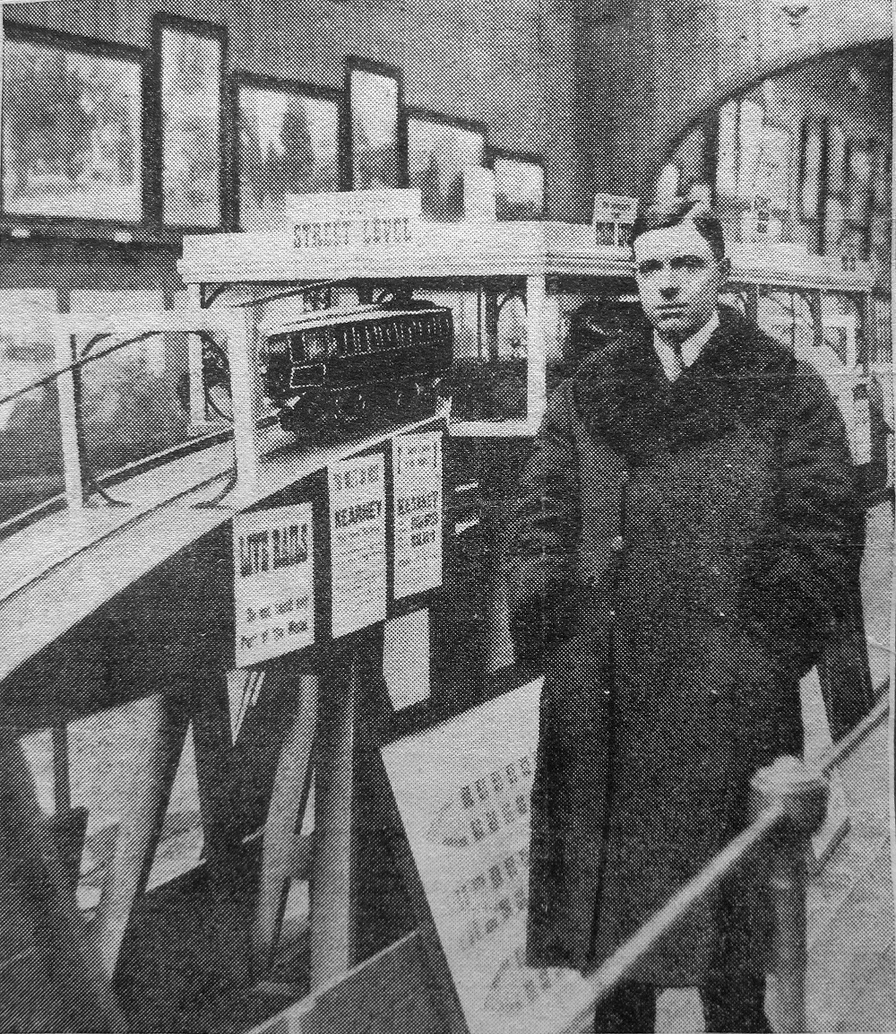
The “Kearney Tube”, as it was known, would be powered by the force of gravity, hurtling down a ⅐ gradient from stations just below the surface like a bizarro funicular before climbing gracefully back up, suspended between a monorail below and a guide rail above, which would (in theory) stabilise the train’s side-to-side motion so as to not induce vomiting in everyone who rode it.
Mr Kearney promoted his invention in cities as distant as Sydney, London, Portsmouth, and (if secondary sources are to be believed) Venice and New York, but it came closest to reality between North and South Shields.
Over sixteen thousand Tynemouthicans signed a petition calling for its construction, and in 1925 the government gave a provisional order approving its construction. Alas, when it came time for a parliamentary committee to give Mr Kearney’s dream the final go-ahead, they were rather more sceptical. He had raised nowhere near enough money to actually build the blasted thing, and the members were quite concerned about the impact it might have on the livelihood of the Tyne’s ferrymen.2
Mr Kearney held a grudge for the rest of his life. He made elaborate, typewritten conspiracy diagrams indicating who was paying off who, and gleefully wrote of the death of his opponents on the committee — or even those who were only tangentially connected:
Under pressure from Lord Ashfield, Henry Ford went back on his undertaking to finance the first Kearney Tube between North and South Shields. Not long afterwards Esdell Ford [sic], Henry Ford’s only son, was taken ill and died.
In 1939,
he gave it one more go, partnering with the LNER — only for the outbreak of the second world
war to put an abrupt halt to any civilian infrastructure plans. He would eventually write
a science-fiction novel titled
Erōne, where his his protagonist’s ideas are proven correct by a utopian society on
Uranus, and if only the good people of Earth would listen!
Mr Kearney died in 1966, never having seen his utopia come to fruition. I was unable to find where or how, or even in which continent he is buried — he split his time between Australia and Britain, and he could plausibly have passed on either side of the equator. Still, i hope he’s up there somewhere, smiling down on all the shweebs, hyperloops, monorails, and other gadgetbahns of today.3
By the nineteen-sixties, the Tyneside Electrics had seen better days. Passenger numbers were falling, the trains of tomorrow were decrepit, and they weren’t even electric — British Rail had deemed it more cost-effective to run slower, dirtier diesel trains. The system had become a kittiwake4 around the North East’s neck. So, in 1971, the local transport executive commissioned a study — and they came back with a plan.
You know how the rest goes. Though the Tyne and Wear Metro would mostly reuse the existing routes mentioned before, they would all be linked up through a newly constructed central core underground — meeting in the middle at Grey’s Monument.
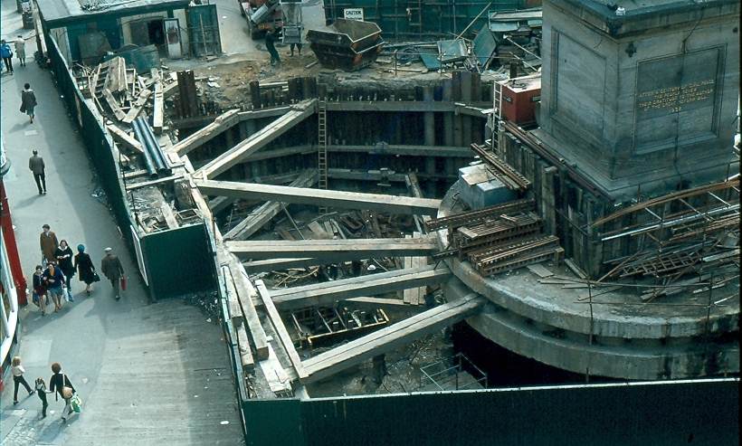
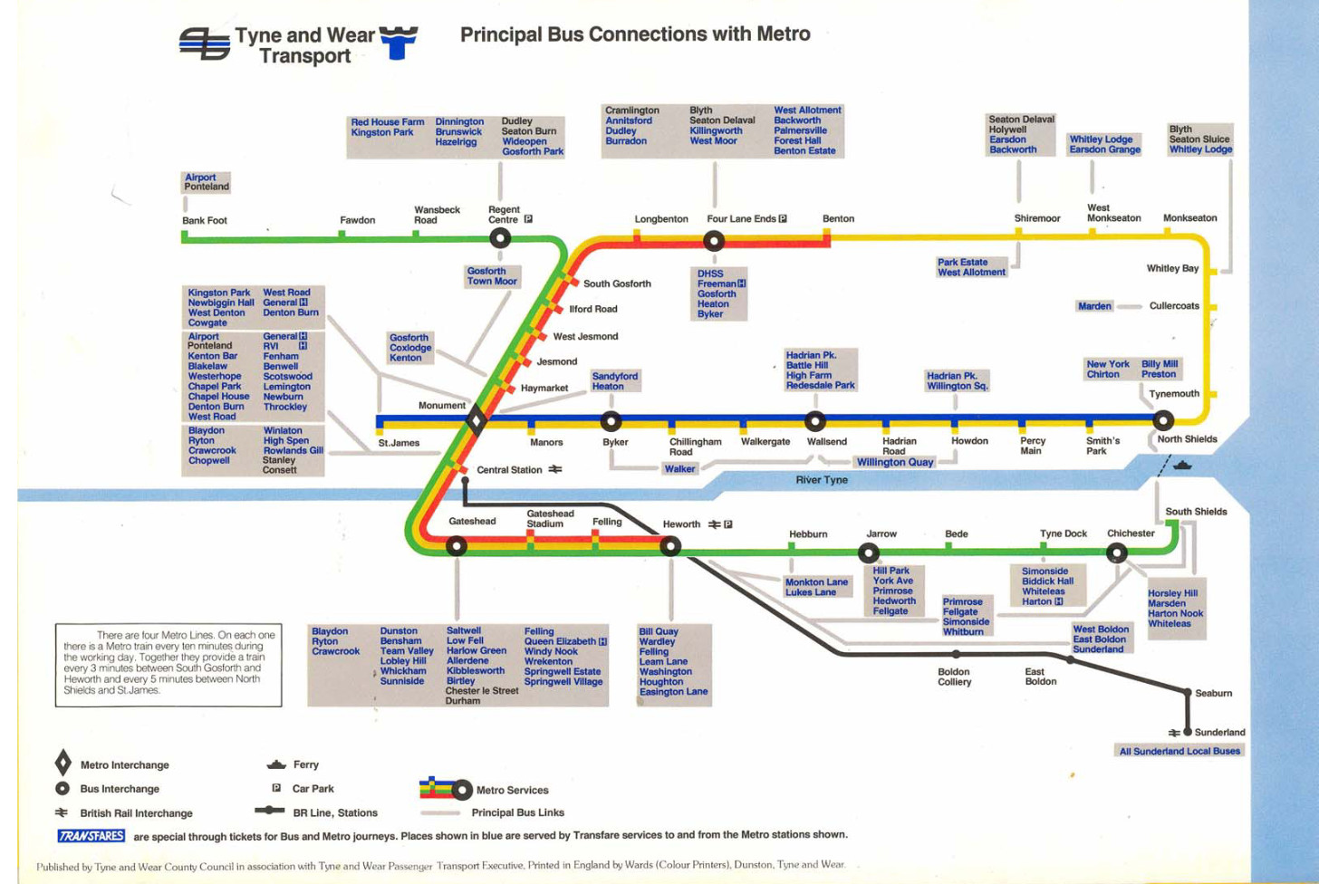
The pretzel shape was completed by proceeding one stop further from Monument to stubby St James’ Park.5 This was just a temporary terminus, of course — the station was built so that, in future, they could easily come back and extend it out to the long-underserved west end of the city. Quoth 1981’s “Tyne and Wear Metro: concept, organization, and operation”:
St James station is at the centre of an area designated for future office development and also serves the football ground; the station has also been designed to allow the system to be extended westwards at some future date.
So, eventually, that happened, right? They turned that little stumpy arm into a full-fledged extension. Right? …Right?
In 1981, environment secretary Michael Heseltine vetoed any further extensions to the Metro system. Since then, the only substantive changes have been in 1991 — inking the airport to the rest of Newcastle — and 2002, when, after twenty years, the Tyne and Wear Metro finally reached Wearside. It is around 2002 that things get a little silly.
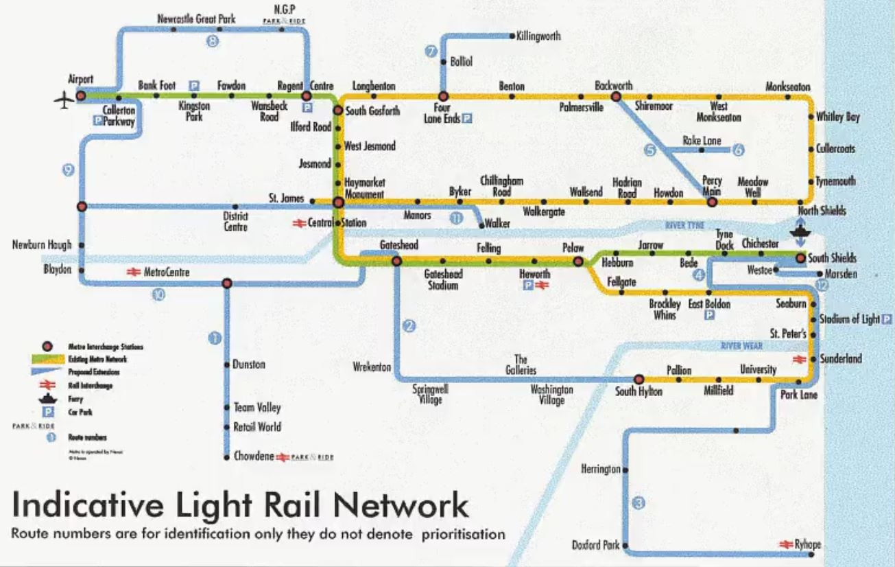
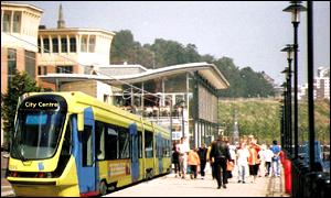
Shortly after service to Sunderland began, Nexus (the local transport operator) announced Project Orpheus, their grandiose plan to build a transport network fit for the twenty-first century. Bus rapid transit for everyone! A cable car in Gateshead! And, yes, the valiant return of trams to Newcastle-upon-Tyne, connecting the west end up with the city centre.
None of this happened. The plans were watered down and watered down until all that was left was the vague idea of refurbishing the Metro and making buses more frequent. The great recession and austerity presumably killed any hope it had left. You still get calls from local councillors to extend the system to their part of the area, but they seem unlikely to amount to much. So is all hope lost?
Well… remember the Blyth and Tyne Railway?
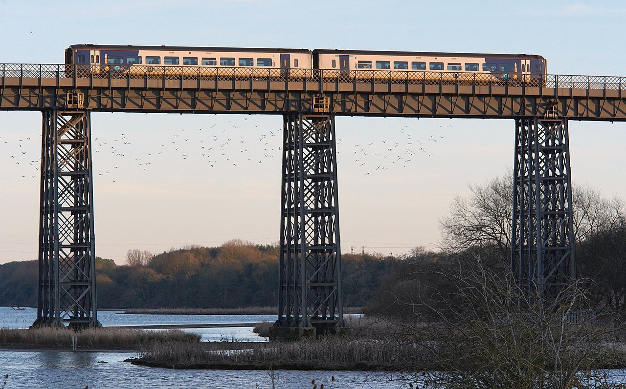
Passenger services along the B&T north of Backworth were given the chop by Dr Beeching in the nineteen-sixties. Combined with the end of coal, this was a one-two punch in the gut for working-class mining towns like Ashington and Blyth, leaving them some of the most impoverished in the country.
Local campaigners have been calling for its reopening since the nineties, initially to little avail barring a token mention in the ill-fated Project Orpheus plan. In 2013, Northumberland County Council started taking the idea seriously. In 2019, the transport secretary gave the thumbs up. In 2021, shovels hit the dirt. And in 2024, for the first time in half a century, trains carried passengers from Ashington to Newcastle.
It may be like pulling teeth, and it may cost more than we might like, but Britain can still build things — and local politicians seem to have noticed! In 2024, work began on the first serious proposal since Orpheus to extend the Metro; this time, to Washington, along the disused Leamside line.
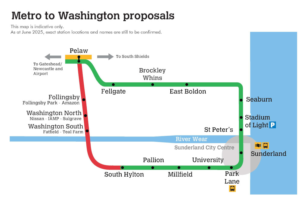
Curiously, the proposed extension goes in yet another loop. It’s hard to imagine this wouldn’t require some rejigging of how the network runs — a third line, perhaps? New platforms at Pelaw? But however they run it, it looks like, if it goes through — and that’s a big if — the Yellow Line may not be alone in its topological weirdness for long.
I’ve done some fairly interesting things this month, and had planned to write posts for each of them — but, for whatever reason, none of them provided that particular spark to me. Maybe they just didn’t seem that interesting to explain to you, the reader, or maybe i didn’t know what to say about them except the obvious.
Nonetheless, it would be a shame for these events to pass into the annals of my journal without telling you about them. So! Here’s a brief summary of my unblogged July thus far.
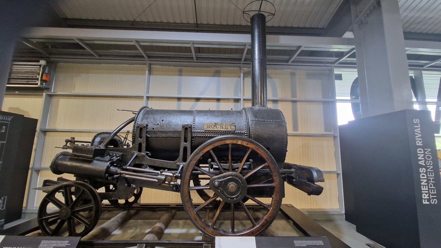
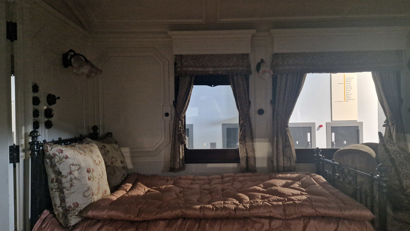
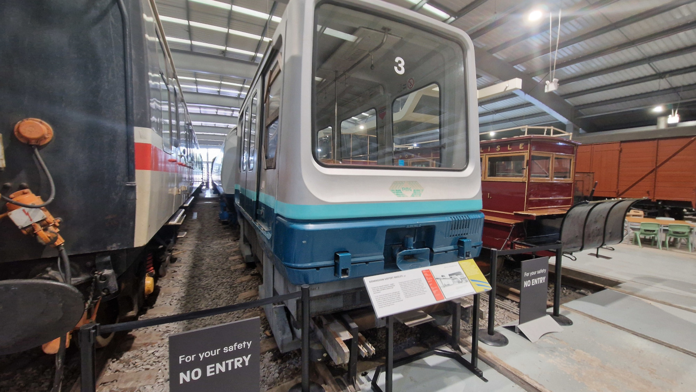
I toddled off to Shildon to visit Locomotion, the local branch of the national railway museum. It’s the birthday of the railways, and thus boasts a disproportionate selection of anorak arcana — alas, you can’t go in the trains, but you get a pretty good look at the inside of Queen Alexandra’s royal train car, the erstwhile Birmingham maglev, and, most proudly, Stephenson’s Rocket.
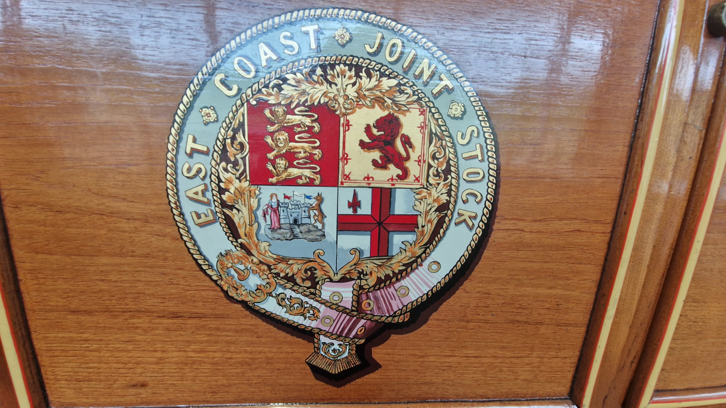
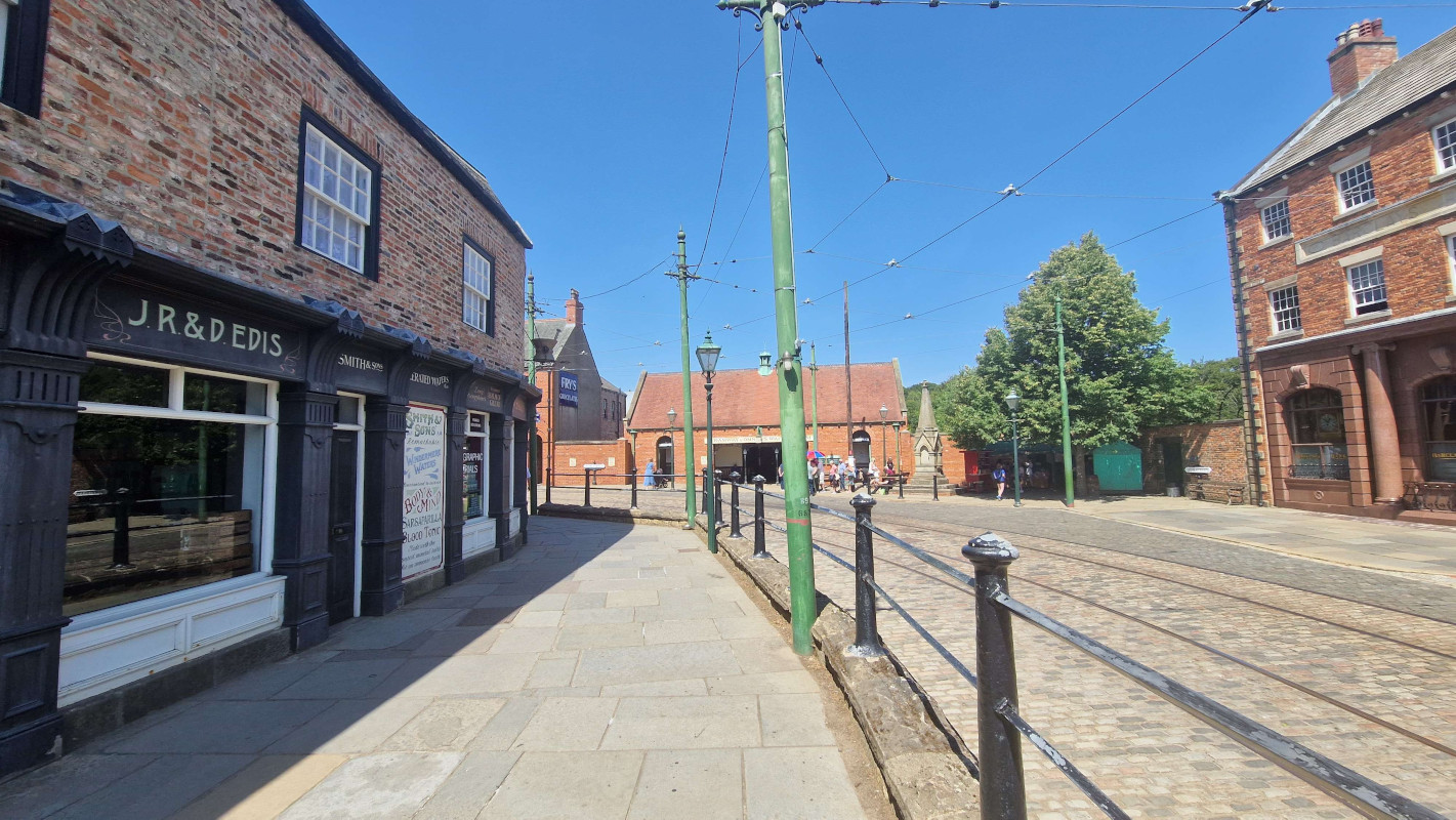
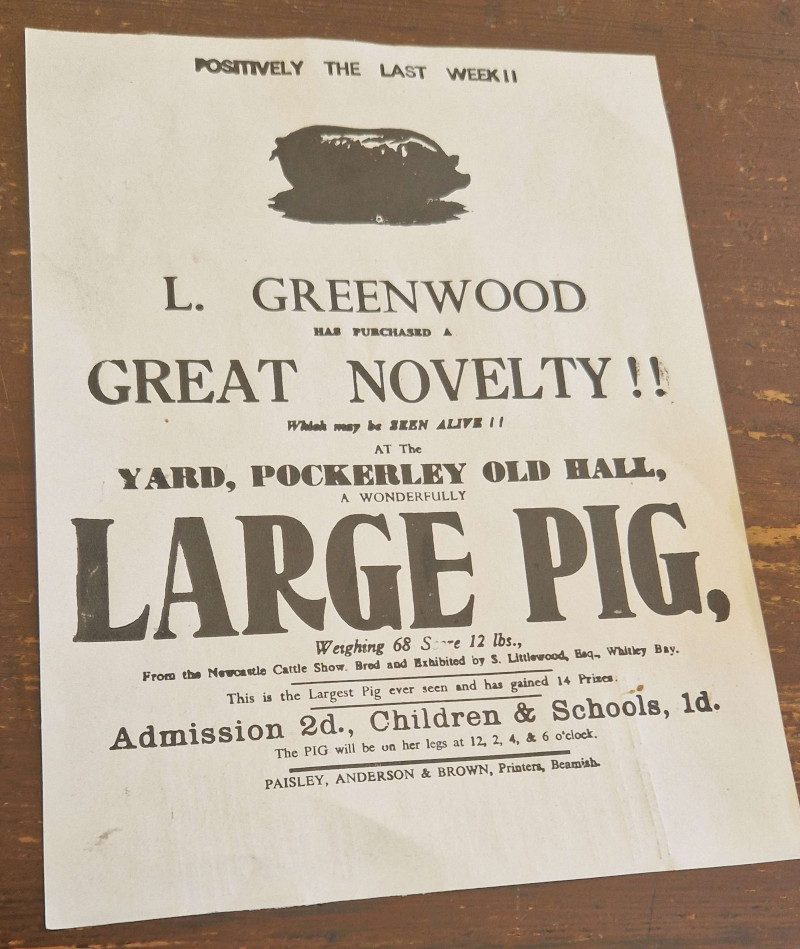
Beamish1 has been newly crowned Museum of the Year, so there was no better time to check it out. I hadn’t properly explored their new fifties town yet — the chippie and the old houses are wonderful, but the record store, crammed up the stairs, across an anachronistically modern mezzanine, and down a grey corridor, leaves much to be desired. Nitpicks about balcony design aside, it’s as great as ever, and, somehow, well worth the £33(!!!!!) asking price.
Finally, just yesterday, i went off to an Elbow concert hosted in a ruined mediæval priory by the sea. Belting out “One Day Like This” in the fading dusk light with five thousand other people standing on the same hallowed ground where monks tried to figure out where baby eels came from is a top-ten human experience.
The industry town of Blyth is bordered on four sides by sights iconic of the Northumbrian experience. To the north lies the eponymous River Blyth, carving out a respectable third to the Tyne and Tweed in how it has shaped the course of the county’s history. To the east, the awesome North Sea ebbs and flows, enticing herds of families out to the beach. Southwards, farms and fields stretch on until they meet the city streets. And, to the west, the dismal grey A189 motorway cuts its way through impoverished streets and empty grassland.
So guess which path the railway sent me down? That’s right, it was hugging the fucking tarmac for me. There’s a reason the God of travellers is a trickster.
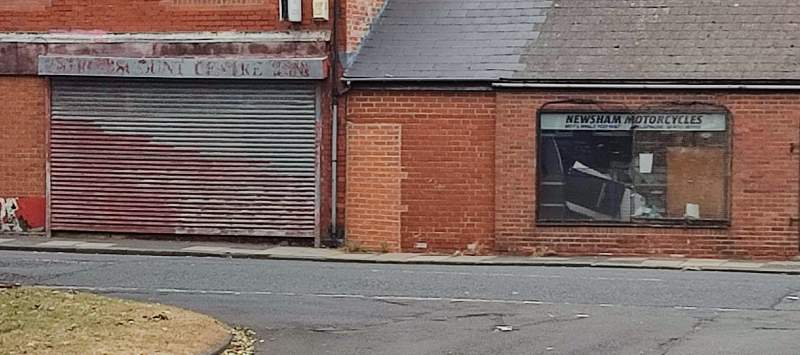
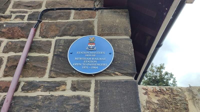
Newsham is perhaps the prototypical post-industrial suburb. The streets are lined with drab row-houses and shuttered shops whose walls sit darkened by cigarette smoke. But even here, there are signs of history, and signs of life. Walking along a small council estate, even in this decidedly hard-to-do area, people's personalities shine through. One car, judging by the bumper stickers, belongs to a proud gay naturist. Another house has a carved relief of an Indian chief (although i doubt the inhabitants have a drop of Native American blood in them). And at the end of the road lies the holy grail: the old station master's house, whose nearby decaying platforms just about peek over the fence.
After this, our path splits in two: the main line continues up to Bebside, but a spur branches off and swings to the town centre. The first one is mostly a boring romp through farmland and reclaimed forests, so, for now, we'll be following the second line.
There are a lot of things about Blyth that i’m sure the town council would love for me to tell you about. It has an historic beach (though it’s all the way on the south end of town, and there’s no reason for you to make the trek when Newbiggin and Whitley Bay are closer and just as nice). There's a weekly market on Thursdays (though on the Thursday i went in, they’d all packed up already), by the plaza next to the shopping centre (whose selection of options is laughable when compared to Manor Walks in the next town over). And they’re dead proud of their local football team, the Spartans, who famously performed somewhat above average in the 1978 FA Cup (never mind that Ashington spawned two World Cup winners).
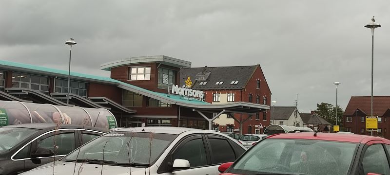
By now you may have noticed that everything in Blyth seems to be a slightly crappier version of something from elsewhere in Northumberland. This goes too for the ignoble fate of its former station. While some have been turned into houses, shops, pubs, or just returned to the land whence they arose, Blyth’s once-proud central station is now… a Morrisons car park.
The branch line itself is now a straight-on footpath, cutting its way through town with a hospital and shopping centre on one side and impoverished estates on the other — until about halfway through, that is, when it suddenly becomes much more suburban in character; charming parks take the place of pools and appendectomies, while a long allotment fills the other side. (It was also — and i cannot stress this enough — absolutely pissing it down by the time i got to this end, and as such, i failed to get any usable footage. Just trust that it eventually meets back up with the main line.)
Back on the main line, the motorway leads to a depressing interchange at Bebside. Just across from the former site of the station sits the grimiest petrol station corner shop i think i’ve ever been to (no photos, alas, again); the site of the station itself has long been bulldozed and turned into a horse riding centre.
I’d love to stay and show you more, but the next phase in our adventure is a big one — because we’ll be taking a brief diversion to County Durham. It’ll all make sense when we get there. Ciao!
Last time on The Garden: A strip mall turns out to be a place of immense historical curiosity, i am interrupted by a rude troupe of boy racers, and find myself caught up in the lyrics of a pro-union folk song.
Leaving Seghill, going past a house with a conspicuous Northumbrian flag, the landscape once again slips swiftly back into ruralia — a common occurrence on this leg of the journey. No sooner had i left behind the station house than i found myself on a dirt path which i wasn’t quiiiite sure i was meant to be on.
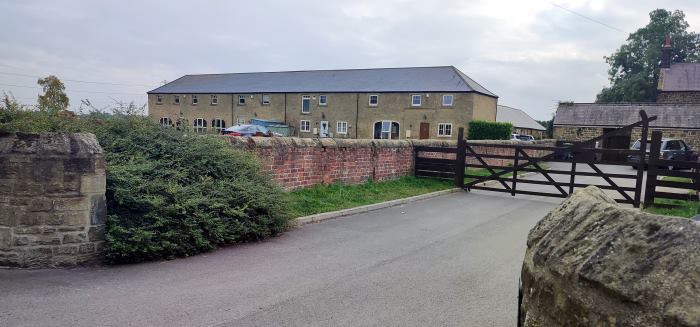
This was the small hamlet of Mare Close, essentially a farmhouse surrounded by a few cottages. I have a sneaking suspicion that everyone living there has been friends since primary school, though i'll never know for sure. Opposite the cottages, by the next leg of my route, lay a small village church and graveyard which i dared not enter. Onwards.
Seaton Delavalα sits at the heart of the valley. Turning one way, there lies a charming local coöperative store, a genuine lordly manor (owned by the town’s namesake De la Val family, who came over after 1066), the previously-blogged village of Holywell, and, eventually, the seaside settlement of Seaton Sluice.β Unfortunately, we’ll be turning the other way, by where once stood a colliery.
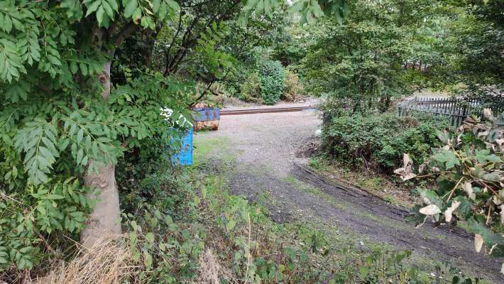
The former site of Delaval’s station can hardly be considered a sight for sore eyes. Cars and lorries pass by, horns blaring, trying to weave their way between those turning into the nearby petrol station.γ The location of the station itself is an uninspiring gravel pit on one site with an overgrown nettle-filled path on the other; next door is a chain pub whose car park will be getting embiggened to accommodate the extra traffic once the railway reopens.
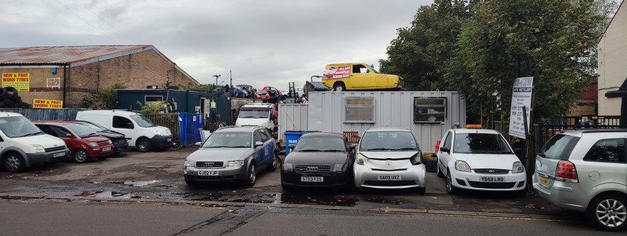
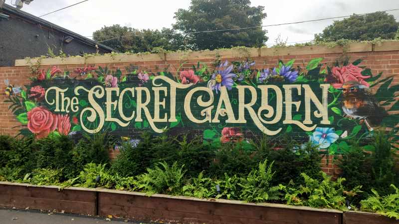
It doesn’t get much better. A few interesting-looking eateries (a grimy-looking café called “Only Fools and Sauces”, a venue by the name of the Secret Gardenδ with a wonderful hand-painted sign) added some initial spice, but soon i was back to the same industrial wasteland: Auto recycling! Furniture wholesalers! Caravan storage! Chemical producers! The works!
...I said something about a colliery, didn’t i?
16 January, 1862. It’s half past ten — or, at least, it might be. You’ve been labouring away in the coal pit since two in the morning, and you’ve not seen the sun since. The shift is almost over, and it’s time to swap over with the next group.
One by one, your comrades file in line to get out. A huddle of people enter the rusting lift. The familiar ketter-ketter-ketter shudders through the cave — but then, for a fraction of a second, all falls silent.
Your heart races. A drop of water falls from the ceiling. Nobody makes a sound.
And then, all of a sudden, it is as though Thor’s hammer has crashed into the ground. The earth around you shakes in terror, lets out what can only be described as an otherworldly scream, as ten tonnes of blood-red steel smash into the floor.
This was the Hartley Pit disaster, and its shockwaves can still be heard across town.
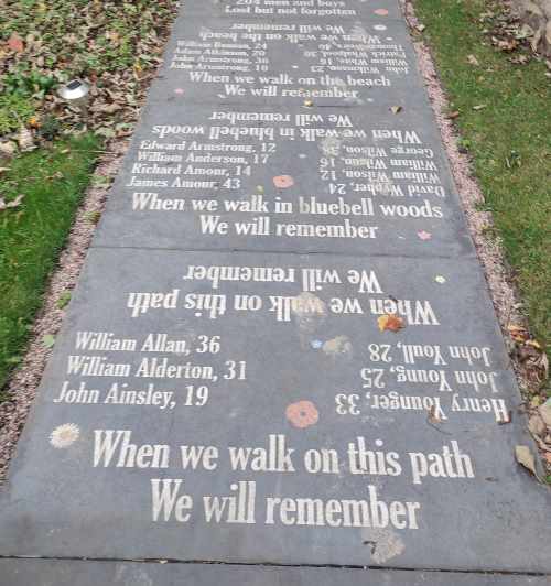
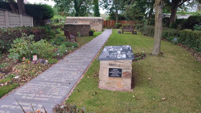
Just across from the telltale jackhammers and yellow tape of a housing estate so new Google Maps hasn’t caught up yetε sits a lovely memorial garden, explaining the story of the tragedy, with a poem to contemplate as you ramble along the path.
In terms of stations, the town has had two — Hartley and Hartley Pit — both right next to each other, and neither seeming to have any chance of reopening.
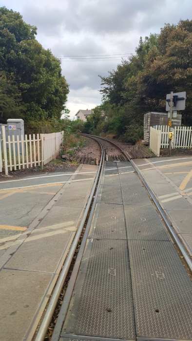
I was a bit anxious about continuing on, because there were several serious-looking men in hard-hats and high-vis jackets, but they didn’t seem to mind. They really, really should have tried to stop me from going to where i was going next.
Coming up on The Garden: your author tries not to disturb some horses, desperately tries to avoid going to fucking Blyth, and accidentally sneaks in a brief trip to Durham. I promise, it makes sense in context.
Last time on The Garden: the axe falls on the Blyth and Tyne line, and i foolhardily decide to walk its length…
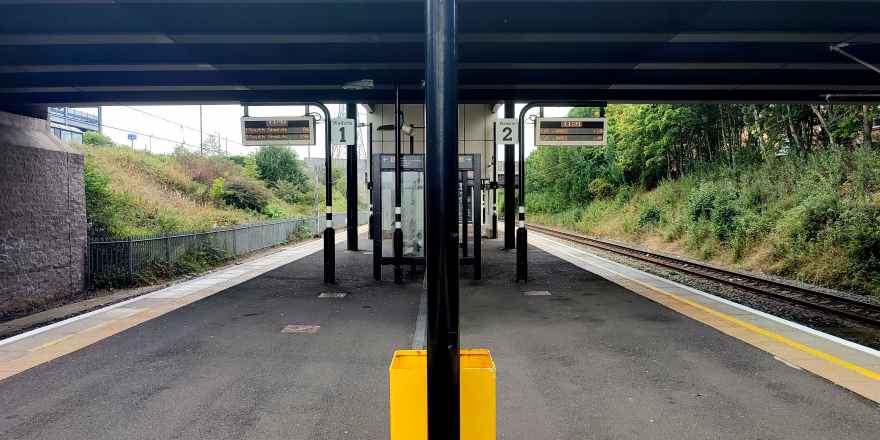
Our journey begins at Northumberland Park, in North Tyneside. Though it’s the first station we’ll be visiting, it was the last to be constructed, having only opened in 2005 — and it’s quite easy to tell, even after sixteen years of wear and tear; the place is outfitted with modern amenities, lifts, ticket machines flush with the wall, and, more lately, pandemic-themed graffiti opposite the platform. This unassuming metro station will, according to the county council’s plans, serve as the interchange between the old and new lines, heavy rail and metro meeting one last time before splitting apart and going their separate ways.

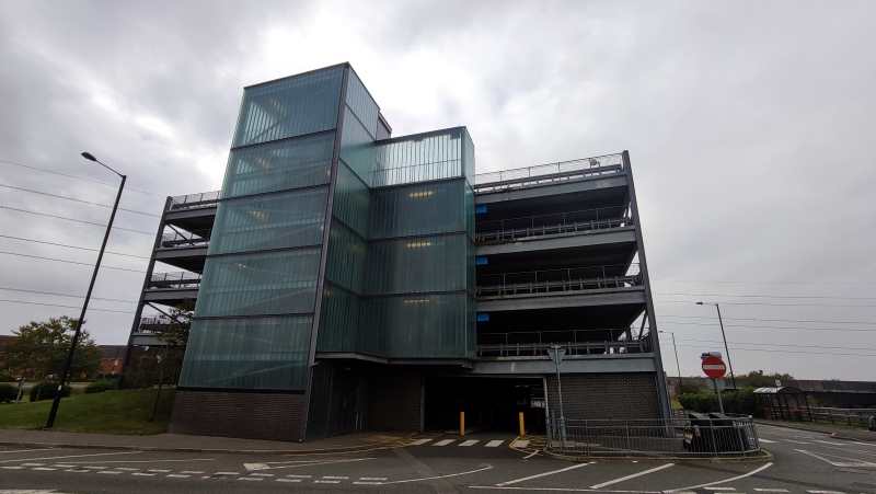
Setting off from there, the first thing that caught my eye were twin giants: a frosted glass-covered car park and a red-brick Sainsbury’s, unexpected icons of the modern British condition. It didn’t get much better from there; down the road lies an American-style strip mall lined with bookmakers trying to get people to piss away all their money.
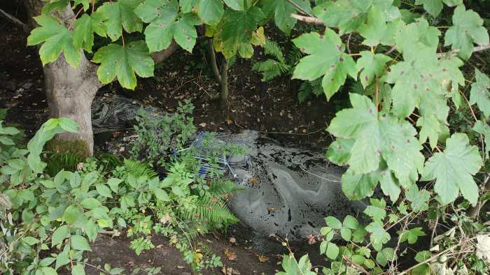
This southernmost tip of Northumberland is criss-crossed by innumerable public footpaths, cycle paths, bridleways, and other routes for non-metal-box-related transport; ducking onto one of the reclaimed “waggonways” once used to transport coal, i found myself on the site of the second station on the list.
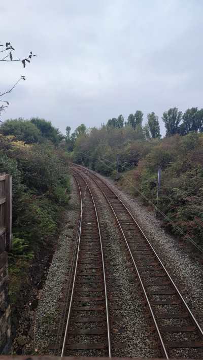
The leafy suburb of Backworth has a habit of burying its history. A hoard of offerings from Roman times was found underground in the 1810s, the last vestiges of the colliery that once was are long gone, and the tale of this sorry ex-station is rather similar. Opened in 1864 to replace a nearby station closing the same day, Backworth station served its community for over 100 years, surviving the Beeching cuts. But when the Tyne and Wear Metro was announced to come to town, the old station finally closed… for good. It wasn’t until the opening of Northumberland Park that there would be a replacement.
As i wandered through the village's verdant streets, i couldn’t help but think of its resemblance to the straight, cycle-friendly streets of my old hometown. A little greenery can go a long way.
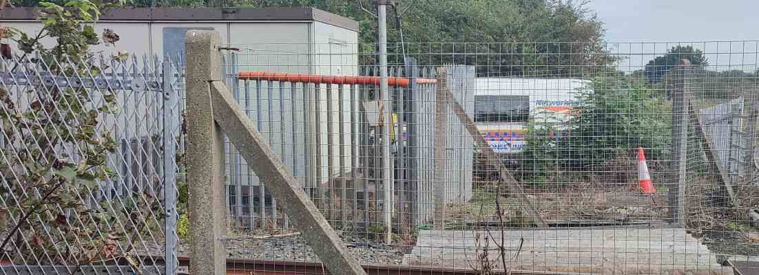
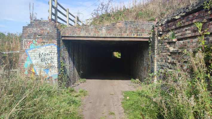
Network Rail were hard at work at the site of the aforementioned original Backworth station, whose plot of land now sits vacant, marking the city’s last hurrah; the further i walked along the dirt back roads, the further the sounds of bustling cars receded, until, ducking under a shady underpass, i found myself utterly alone amongst pastoral fields (and the overwhelming scent of manure).
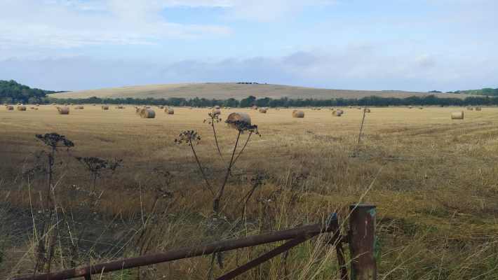
That peace and quiet was swiftly interrupted by a troupe of boy racers on motorcycles and quad-bikes, but you can’t win them all, you know?
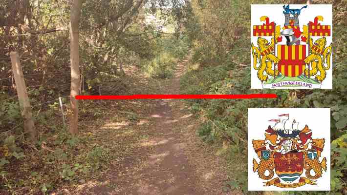
The (post-1974) border town of Seghill occupies only the tiniest fragment of the collective English consciousness, popping up briefly in an anti-scab miners’ folk song called “Blackleg Miner”:
It’s in the evening after dark,
when the blackleg miner creeps to work
With his moleskin pants and dirty shirt
there gans the blackleg miner![...]
So, divvint gan near the Seghill mine
Across the way they stretch a line,
to catch the throat and break the spine
of the dirty blackleg miner[...]
So join the union while you may
Divvint wait till your dying day,
for that may not be far away,
you dirty blackleg miner!
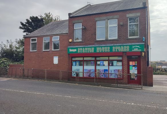
For our purposes, it’s chiefly notable for the fact that it’s the first disused station on the list whose buildings are still intact and in use, this time as a corner shop, from which i of course bought a copy of the local rag — prominently including a Q&A about the restoration of service on the line, which i thought a fitting reminder of why i set out on this silly old journey in the first place.
After getting some well deserved rest, i headed on off towards the next town over, awaiting what fresh stories i would find...
Next time on “Walking the Blyth and Tyne”: your author is reminded of her own mortality, finds himself in the company of a noble family, and shudders at the thought of having to go to Blyth, of all places on Gods’ green Earth
It’s March of 1963. The island of Great Britain is in the throes of its coldest winter in two decades, senior frontbench MP Harold Wilson was recently handed the reins of the Labour party, the Beatles have just released their debut album, and, somewhere in the bowels of Whitehall, Dr Richard Beeching is writing a report that will change the country’s connecting tissue forever.
Dr Beeching, you see, is the chairman of British Railways, the state-owned company in charge of rail transport, and they’re in a spot of financial trouble. British Railways are in charge of running fifteen thousand miles of track shuttling between about four and a half thousand stations, and the only way they can do that is via generous subsidies from Her Majesty’s Government — something which the governing Conservatives, as a rule, are never too happy about.
So, pen in hand, he takes a metaphorical axe to the network, marking about half of the island’s stations for closure. It’s not pleasant, but it has to be done — and, after all, people can just take the car to their nearest station if their town’s is shut.i I’m sure it won’t be too bad.
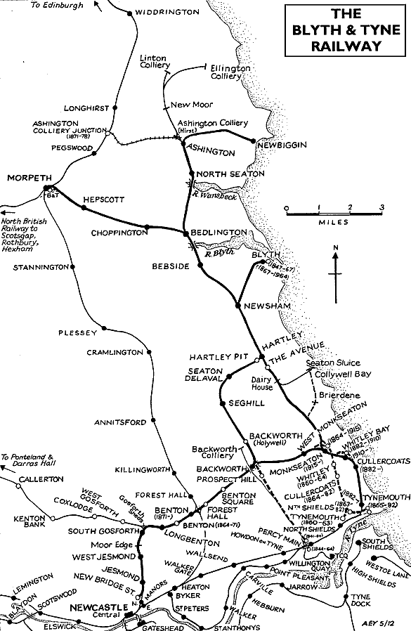
That's how, a year later, the last passenger trains ran along 5,000 miles of railway across England, Scotland, and Wales, including those connecting the mining heartland of industrial Northumberland. The Tyne and Wear Metro, opened in 1980, allowed some of these lines to reopen in Newcastle’s suburbs and (relatively) affluent coastal communities. But just a few miles north, the former Blyth and Tyne Railway has lain dormant ever since the axe fell… until now.
In recent years, the stars have aligned, and both the county council and Westminster have agreed to reopen the line, finally bringing these proud towns back together. The Blyth and Tyne Railway, now rechristened by the more attractive name of the Northumberland Line, is set to reopen by 2024. To celebrate this historic moment, i thought i’d see what has become of the stations and towns that were. I’ve identified fourteen stations, past, present, and future, along the line, and i’ll be walking between each of them in turn, seeing what stories they tell. The list includes:
Won’t you join me?

